GeoChat capabilities for Geo Data! 🌎
So essentially,
GeoChat can recognize buildings and features in map/satellite view
Paper: GeoChat: Grounded Large Vision-Language Model for Remote Sensing (10 Pages)
Researchers from multiple organizations such Mohamed bin Zayed University of AI, Birla Institute of Technology & Science - Hyderabad, Australian National University, Linköping University through this research highlight that general-domain Visual Language Models, while proficient in natural image domains, struggle with the unique characteristics of Remote Sensing images.
Hmm..What’s the background?
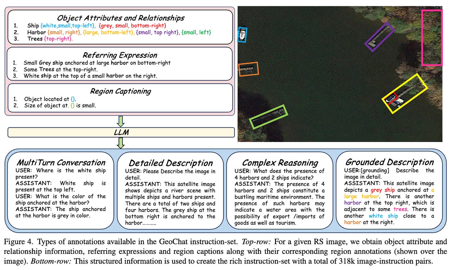
While Large Vision-Language Models (VLMs) have demonstrated considerable success in natural image domains, their application in Remote Sensing (RS) has been limited. Existing research in RS has primarily focused on specific tasks like image captioning, zero-shot classification, and visual question answering. These task-specific models lack the conversational capability and generalized semantic understanding of RS images that general-domain VLMs offer.
RSGPT represents an initial attempt to bridge this gap by offering conversation abilities and multi-task functionality in the RS domain. However, RSGPT requires separate fine-tuning for each task, limiting its generalizability and efficiency. Additionally, it lacks support for region-level reasoning and visual grounding, crucial aspects for interpreting the detailed information present in RS images.
Ok, So what is proposed in the research paper?
GeoChat's architecture is based on LLaVA-1.5 and includes three main components:
Global Image Encoder: Uses a pre-trained CLIP-ViT (L-14) model to encode the input image into a set of visual tokens
MLP Cross-modal Adaptor: Projects the visual tokens from the image encoder into the language model's embedding space.
Large Language Model (LLM): Employs the Vicuna-v1.5 (7B) model to process the combined visual and textual information and generate responses.
The model is trained using a Low-Rank Adaptation (LoRA) strategy to efficiently fine-tune the LLM while preserving its general language capabilities
What’s next?
The authors emphasize the importance of domain-specific training data and highlight the model's ability to handle the complexities of RS imagery, including high resolution, diverse scales, and the need for region-level reasoning. Future work could focus on
Enhancing object detection accuracy
Enhancing localization of multiple objects within an image
Enhancing datasets with challenging scenarios, such as images with dense object clusters or varying object scales
So essentially,
GeoChat can recognize buildings and features in map/satellite view


